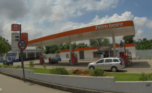
PLACE collects two image products, PLACE Aerial and PLACE Ground. We repeat collect these image products for urban centers in Africa and small island states in the Caribbean and the Pacific.
PLACE Aerial is a geo-referenced collection of optical (RGB), nadir aerial images. An image collection is a set of individual images collected for area of interest e.g. a flight line, a project site or a city acquired with an Unmanned Aerial Vehicle (UAV). Images have an average GSD of 5 cm, a minimum forward overlap of 60% and 30% side lap and a typical radiometric resolution of 24-bit (3 x 8 bits per band). Images are geo-tagged by means of carrier phase differential GNSS and exposure event marking, yielding fixed and float solutions with an average positional accuracy of 20 – 30cm. Image collections are delivered in JPEG format with associated metadata. For larger areas imagery is collected using aircraft.

PLACE Ground is a geo-referenced, de-identified collection of optical (RGB), 360-degree terrestrial images. An image collection is a set of individual images collected along a route (e.g. an alley, street or road) with a 360 degree horizontal field of view without any gaps, using mobile mapping platforms with an on board GNSS, geo-tagged with a typical positional accuracy of between 2 and 5 meters and at least 4K resolution. Faces and number plates blurred. Image collections are delivered in JPEG format with associated metadata.

